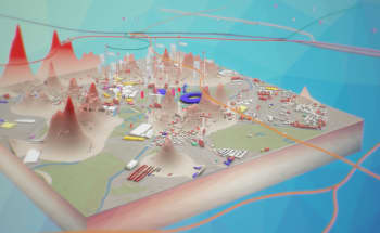
A digital future for spatial planning
A groundbreaking report from the Digital Task Force for Planning is helping the UK planning profession use new, digital approaches
“In this world we live in, everything is connected to everything else. The impact of the planning process is no more or less than all of us being involved in our environment.”
Internationally renowned town planner and urban designer Dr Wei Yang, along with Professor of Planning Michael Batty from The Bartlett Centre for Spatial Analysis, co-founded the Digital Task Force for Planning in 2021 to address the climate crisis and other Grand Challenges facing our society.
The Task Force consolidates cross-disciplinary research and tools that can be applied in spatial planning, identifying research gaps, and developing practical solutions. It also aims to function as an incubator of digital planning innovation and help promote capacity building through training and knowledge sharing.
In 2022, Dr Yang and Professor Batty set out a comprehensive blueprint for improvement in their report, ‘A Digital Future For Planning: Spatial Planning Reimagined’. They also outlined multiple systemic failings of the UK planning process – a system that has largely remained unaltered since the 1940s.
Reinvigorating the planning profession
“We want to reinvigorate the planning profession. When the profession first started, it was visionary and had long-term thinking, asking big questions related to society's needs. There was great support from society. But now planning is disconnected with the public, who don't see planning as something positive anymore - more a kind of administrative bureaucracy,” says Dr Yang.
Due to a variety of factors, the planning profession in the UK has failed to capitalise on the opportunities offered by digital technologies. Austerity has undoubtedly played a part in this failure, as cost-cutting measures across the public sector have left planners at both the local and national level struggling to ‘do more with less’.
According to Dr Yang, the problem isn’t the absence of technologies such as Geographic Information Systems (GIS) and computer-aided design (CAD) from the planning process. It’s more an issue of poor integration that leaves the planners on the periphery.
“People see GIS or CAD as a technical skill. So normally, there’s a separate group of people doing GIS, rather than the planners. And if the planners don’t understand how to use GIS and other digital tools, they can’t frame the question adequately – and for data literacy and data analytics, framing a good question is the number one priority.”
New ways to use data and technology
By integrating data and digital technology, the Task Force has created a new methodology that provides decision makers and stakeholders with a better understanding of the interactions between people, economy, society, the built and the natural environments.
The methodology can be visualised as two interrelated loops. The Evidence Analytics Loop provides systematic approaches to the gathering and processing of multidisciplinary data and evidence. Outputs are then integrated into the Decision-Making Loop, allowing planners, governments and communities to shape evidence-based policies and regulations which are accountable to the public.
The loops define cycles that enable the planner to iterate and explore ideas while also engaging in plan-making in real time. This methodology can be applied universally to planning tasks either nationally or locally, in any sector, at any scale.
Digitalisation as an instrument of change
One of the Task Force’s primary aims is to translate complex and fragmented digital systems into methods that practising planners and consultants can use more effectively.
A wide range of research disciplines and styles is essential to achieving this aim. The Task Force has entered a Memorandum of Understanding with the UK Collaboratorium for Research on Infrastructure and Cities (UKCRIC), in order to bring the latest scientific and engineering research into planning.
“We often refer to the ‘teaching hospital model’ - in medical schools, you’ll have a leading clinician or practitioner, who also teaches and researches. So, the latest research is brought into practice very fast.
“But in planning, there’s still a degree of disconnection between research and practice. The most important research is about, ‘what are the possibilities?’ And then, ‘what is the solution?’”, says Dr Yang.

The race to net zero
“The IPCC identified spatial planning as one of the key mechanisms to tackle climate change. 59% of the carbon reduction needed will come from human societal and behavioural changes. So if we only think about the physical objects without thinking about human beings, we’ll miss the biggest trick,” explains Dr Yang.
Despite clear repeated recommendations from every IPCC Assessment Report since 2014 and the UK Government’s 2020 white paper, ‘Planning For the Future’, there’s still an absence of national cross-departmental consideration of how planning processes could be redesigned to deliver net zero goals in the UK.
With the impending overshoot of 1.5°C global warming expected to potentially trigger multiple climate tipping points, the responsibility of spatial planners in helping to reduce further carbon emissions is upheld by the Task Force.
“I often describe the Task Force as a ‘digital National Trust’ – it promotes valuable knowledge sharing as assets for public good. Our research outcomes are made open source worldwide,” says Dr Yang.
“It’s based on the notion that in this world we live in, everything is connected to everything else. The impact of the planning process is no more or less than all of us being involved in our environment,” says Prof Batty.
Read the report
A Digital Future for Planning: Spatial Planning Reimagined
Michael Batty and Wei Yang, Digital Task Force for Planning

About the authors
Dr Wei Yang
Co-Founder & CEO, Digital Task Force for Planning; Chairman, Wei Yang & Partners; Honorary Professor, The Bartlett Centre for Advanced Spatial Analysis, University College London
Dr Wei Yang is an internationally renowned town planner and urban designer who champions a place-based, whole-systems approach to tackle the grand challenges of our times. She is an influential thought leader and a powerful advocate for climate action, nature-based solutions, health and well-being, and social equality. She was named a Net Zero Hero by Digital Leaders in 2022.
Wei is the Chairman of Wei Yang & Partners, an award-winning master planning firm in London. She possesses extensive experience in managing multi-disciplinary teams. Her professional strengths lie in combining innovative planning inspirations with feasible implementation solutions. Wei is a leading figure in researching, promoting, and implementing 21st-century garden city and green and low-carbon development approaches worldwide.
Prof Michael Batty
Professor of Planning and Chair, The Bartlett Centre for Advanced Spatial Analysis, University College London; Co-Founder & Chair of the Digital Task Force for Planning
Mike has worked on computer models of cities and their visualisation since the 1970s and his recent publications Cities and Complexity (2005), The New Science of Cities (2013), and Inventing Future Cities (2018) all from The MIT Press. His latest book The Computable City (2023) is a history of how computers and digital technologies have and are changing the form and function of cities.
He is a Fellow of the British Academy (FBA), the Royal Society (FRS), the Academy of Social Sciences and the RTPI. He was awarded the CBE in the Birthday Honours List in 2004. He received the Gold Medal of the Royal Geographical Society (2015) and the Gold Medal of the Royal Town Planning Institute. He has been the editor of Environment and Planning B: Urban Analytics and City Science, since 1982.
Story produced by All Things Words
© UCL The Bartlett 2023